The Other Side
Saint Andrews, New Brunswick: August, 2018

Basalt and seaweed at Bar Road, Saint Andrews
If you travel in the natural world, you have probably noticed places where the bedrock seems to vary drastically and dramatically over a short distance. Perhaps you have seen a place where rocks of different colours are abutted against one another, or where bedrock textures and lineations change. In some cases, this may represent a variation in the deposition of ancient sediments through time, or a place where there is an unconformity (a long time gap in rock formation), or perhaps a fault that has resulted where the deep forces of tectonism have shifted and reorganized the locations and orientations of pre-existing bedrock units.
A rarer situation occurs where the very different rocks are of much the same age, and where the different appearance reflects sharply contrasting geological processes that were operating within an area during a brief interval of time. The Saint Andrews area is a good example of this. As I mentioned in the previous post, the Upper Devonian Perry Formation (about 360-380 million years old) is characterized by two strongly contrasting sets of rocks: sedimentary sandstones and conglomerates, and volcanic basalts.

Basalt at Bar Road
In readily-accessible parts of the Saint Andrews area, you can observe both rock types: substantial exposures of the sedimentary rocks can be seen and walked over at Pottery Cove, and in other places such as the south side of Indian Point. If we step off the red sandstones and conglomerates on the Pottery Cove tidal flat, get on a bicycle, and ride northward, in about 10 minutes we will be on the shore at Bar Road. Here, on the other side of the peninsula we are still on bedrock of the Perry Formation, but the rough grey-black basalt gives the shore an entirely different shape and feel. The Geological Highway Map* describes it as “massive and amygdaloidal basalt”: the massive part simply means that it is relatively homogeneous and lacks layers, but perhaps you are a bit flummoxed by that fifty-dollar word, amygdaloidal. An amygdaloidal volcanic rock is one that contains amygdules, gas bubbles (vesicles) in the originating molten lava that became filled with another mineral after the lava cooled. The amygdules and vesicles help to give the basalt its distinctive roughness.

Geologists who have studied the Perry Formation in three dimensions have discovered that the basalts are interbedded with the sandstones and conglomerates. This means that layers of basalt lie between the layers of sedimentary rock. When the rocks were being formed, most of the time sediment was laid down by the ancient streams and alluvial fans, but periodically there would be volcanic activity with an outpouring of basalt, then a return to sediment deposition.
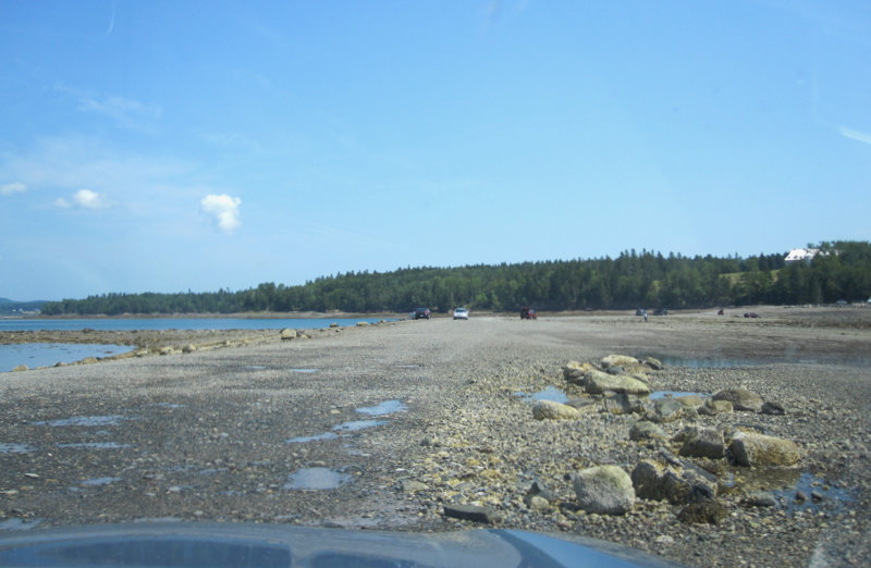
The afternoon is still and hot. There are several cars parked here, with beachcombers and tourists beside us on the beach and out on the bar that gave Bar Road its name. We could have also observed the basalt at Joe’s Point, much closer to our starting point at Pottery Cove, but we stopped to look at it here because today our destination is at the other end of the bar. Most of those beachcombers are actually waiting for the tide to recede from the entire top of the bar, at which point the gravel and shingle surface will become the public road to Minister’s Island. That island was once the summer home of William Cornelius Van Horne, President of the Canadian Pacific Railway, and his mansion and estate are perfect for a wander on this sort of a day.


Van Horne’s bath house at Minister’s Island
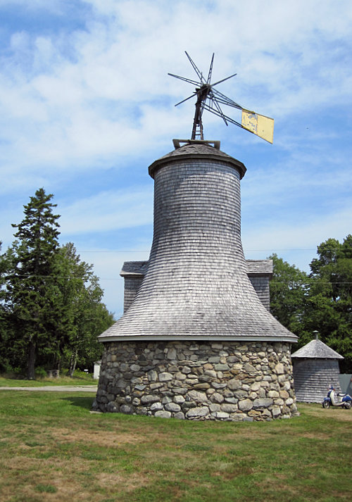
The Minister’s Island windmill
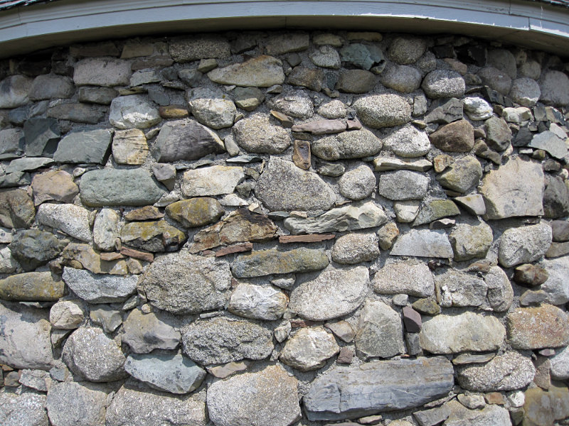
The windmill is constructed from beach stones

The Minister’s Island garage

* Ferguson, L., and L.R. Fyffe. 1985. Geological Highway Map of New Brunswick and Prince Edward Island. Atlantic Geoscience Society Special Publication No. 2.
© Graham Young, 2019


This is really nice, thanks Graham. Another good place to see the conglomerate is around the ferry wharf at Blacks Harbour. The basalt crops out in the shoreline across the narrow bay, where it shows a slight angular unconformity with the sandstone beds.
Greg, many thanks for your comment. I have spent many hours walking on that conglomerate at Blacks Harbour, but I have to admit that my attention there was generally distracted by intertidal life! I will take a close look at the relationship to the basalt the next time I have the opportunity to get to Grand Manan.
Happy New Year and thanks for a new year story.
Thank you.