A Return to Sloop Cove
Sloop Cove, Churchill, Manitoba: August, 2015

Some years ago, I wrote a post that included images of some of the 18th century graffiti at Sloop Cove, which is on the west shore of the Churchill River estuary opposite Churchill. This turned out to be a topic of interest to quite a few people, and I always intended to follow up with more of the words and images that are scratched and carved into the hard Churchill quartzite at that site. In 2015 I was fortunate to have the chance to re-visit Sloop Cove, and took advantage of that opportunity to photograph almost all of the carved names, images, and dates. This post presents some of these more recent images.


A swarm of names, initials, and symbols on one of the quartzite surfaces. I’m not sure of the significance of the axe (or is it a hammer?) beside the name Smith.
To tell the story of why the Sloop Cove inscriptions exist, I don’t think I can do better than to quote my previous post:
“Then we saw what the fence was protecting: scratched into the quartzite were many signatures and other markings from the early fur trade days, not just Hearne’s! The great majority of these date from the mid 18th century, with a smattering of more recent examples (it appears that Parks Canada removes anything added nowadays, though). But why are they here? And why did these men spend so much time laboriously carving into this famously hard and tough stone?

An overview shows names spread across the surface. The “erasures” mark places where Parks Canada has removed uninvited modern graffiti.
The answer lies in the use to which the cove was put in those early historical times. Although we like to think of land as stable and solid, the Hudson Bay Lowlands have been rising ever since the removal of a huge weight of glacial ice a few thousand years ago. Various estimates have been made for the Churchill area, but it is most likely that the river mouth has been rising about one metre per century, and as a result Sloop Cove has risen two metres plus since the 1750s (a pdf showing detailed analysis can be found here).

The mouth of Sloop Cove is now above the normal high tide level.
Back then, the bottom of the cove was probably flooded by salt water at very high tides, and in any case it was close enough to sea level that small ships (sloops) could be hauled out there. Of course this may have been done for maintenance, but most importantly this was the first really protected spot upriver from the Prince of Wales’ Fort, and it was essential to get boats out of the river in winter so that they were not subject to ice damage.

Mooring rings attached to the quartzite facilitated the hauling of small ships.
Even now the sea ice at Churchill can remain well into the time that southerners think of as “summer”, and as a result the men waiting to re-launch their little ships would have had many days of warm weather before they could set sail. What better way to pass the sunny hours than to leave your mark on the stone? Permanently, as it turned out.”

The Royal Navy bomb ketches Furnace and Discovery spent the winter of 1741-42 at Sloop Cove during an unsuccessful search for the Northwest Passage.


The striations (lines) across the quartzite surfaces demonstrate that the bedrock at Sloop Cove was smoothed and shaped by glaciers during the Ice Age.

Samuel Hearne’s signature is the most famous and most frequently reproduced of all the inscriptions at Sloop Cove. Given the artistic quality of this work, and the auspicious date that was selected (exactly 100 years before Canada’s Confederation), I am suspicious that the date at least may be a more recent addition.


Perhaps “P” meant to come back and finish his name, but just never got around to it?


For more details, please refer to Lorraine Brandson’s excellent book:
Brandson, Lorraine E. 2011. Churchill Hudson Bay: A Guide to Natural and Cultural Heritage. Itsanitaq Museum, Churchill, MB.

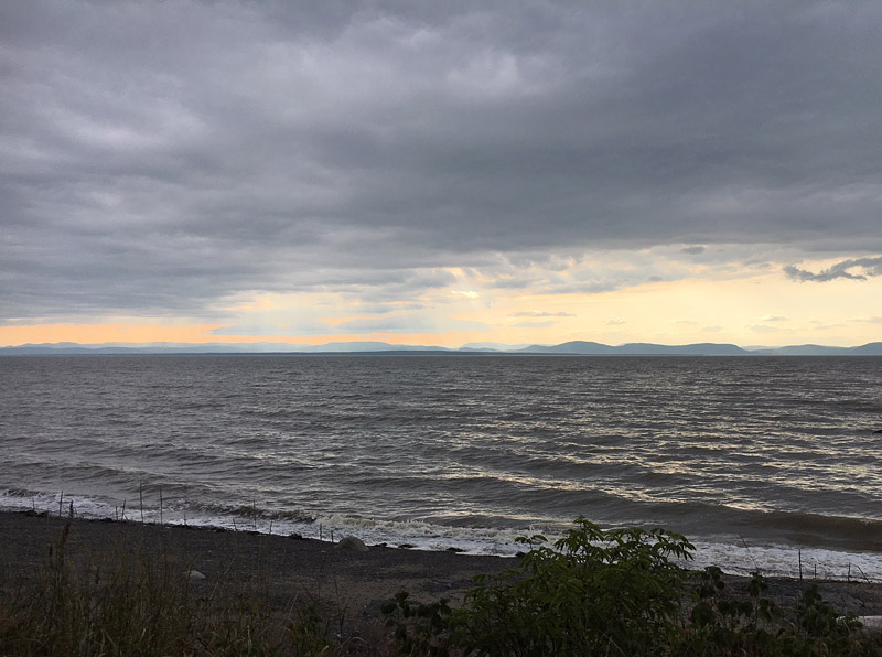
Even now the sea ice at Churchill can remain well into the time that southerners think of as “summer”. This photo shows ice on Hudson Bay during our visit two weeks ago, on June 17, 2019.
© Graham Young, 2019
The Bones of the Earth
Rivière-du-Loup, Québec: August, 2018
This summer, while walking on the shore at Rivière-du-Loup, I was struck by the way in which the spectacular steeply-dipping sedimentary beds “dive” and become submerged beneath the scarp on one side and the water on the other, disappearing as they are covered by overburden or waves. This got me thinking about human perception, and our general lack of appreciation for the hidden geology beneath us.

La Pointe outcrop at Rivière-du-Loup
Today, more than half the people on this planet live in urban areas. For those of us in cities, the Earth is often just that: earth. Many of our biggest cities have been built in relatively flat, low-lying areas, and if we happen to notice a natural substrate below the parking lots, asphalt, buildings, and lawns, it is likely that we will only see soil, clay, or gravel.
Most of the time, most of us never think about what might be beneath that compacted, ashy, polluted soil. Do many city people maybe assume that the soil just “goes down all the way”? Is the Earth flat, or does it sit on the back of a giant turtle?

The faulted succession at Rivière-du-Loup represents deep-water sediments.
I live in Winnipeg, and in Winnipeg the land surface is clay: clay soil, Lake Agassiz clay deposited in an ancient glacial lake, river clay laid down as the Red River migrated across its floodplain. It is literally clay everywhere, and when I talk to people about what is beneath their feet, they are generally surprised to learn that there is anything other than clay in the immediate vicinity. But sure enough, if you go down 15 or 20 metres, through the soil, the Lake Agassiz clay, and the boulder clay below that, you will reach the weathered upper surface of Ordovician dolostone laid down in a tropical sea hundreds of millions of years ago. And if you continue down through the bedded dolostones and limestones, more than 200 metres deeper you will hit granites and gneisses. And those Precambrian rocks go down a LONG way.
Most of us are very good at ignoring any aspect of the world that doesn’t concern us immediately, but if you travel with an inquiring mind you can find clues in so many places about what lies beneath. If you go to the mountains or to a rocky seacoast, you are bound to see many cliffs made of solid bedrock. Or perhaps you live where you can walk up a nearby hill and see a spine of rock poking out in one or two places.

Spines of rock sticking out in one or two places: bedrock stands out on an island in the St. Lawrence near Rivière-du-Loup.
Do you assume that the solid bedrock only occurs in those places where you can see it poking out? On the contrary, the bedrock is like the bones beneath Earth’s skin, and you only see some of it because the skin is absent in those places. If you look at your hand, you can’t see the bones, the carpals, metacarpals, and phalanges. But you know that the bones are there. The bones of the Earth go “all the way down” – you might see them in just those few places, but they are always there beneath you – and the solid or somewhat solid rock goes right down through the crust and mantle until you reach Earth’s liquid outer core.
Earth’s bones are everywhere. Under the mountains, of course, are sediments folded and wrinkled like bedclothes, huge granite plutons, faulted gneisses, deep crust extending down tens of kilometres. That bedrock also continues under the prairies, with flat-lying or gently tilted limestones and shales. The continent’s crust continues out past the land’s edge along seacoasts and continental shelves, making its transition to thinner basaltic crust that underlies all the immense ocean basins.

Geologist and assistant examining outcrop at Rivière-du-Loup. (photo: Vicki Young)
Geologists go out and examine all those bits of Earth’s bones where they poke out, and it is (relatively) easy for them to figure out what is going on with the geology in those places. But it is important for us to understand the structure of the Earth everywhere, if we are going to locate drinking water, find oil and minerals, or keep people safe from natural hazards. This means that geologists also have to figure out what is below you in all the places where the bones are covered by skin. A century or more ago, we mostly knew what was going on below the surface if someone excavated a test pit to see if there was stone suitable for quarrying, or if an oil well or deep water well had been drilled. But then we realized that a section into the Earth could be pulled out almost intact, in the form of a drillcore. And that drillcore will tell us what is directly below, hundreds or thousands of metres straight down. When the geophysicists really got going, applying the study of earthquake waves, gravity, and many other phenomena to the understanding of the Earth’s structure, they were able figure out even more, far beyond the reach of direct methods.

In the past few decades, we have developed an understanding of the Earth’s structure that is much more complete than what was known when I started studying geology in the 1970s. This is important knowledge for everyone: whether we like it or not, we all depend on petroleum for our quality of life, we all need metals and other products made from minerals, it is essential to have consistent sources of water, and our cities and structures should be kept safe from natural hazards such as earthquakes and landslides. Our knowledge of the Earth’s structure takes many of the “unknowns” out of decision-making processes, as long as the decision-makers pay attention to it. In a democratic society, we are all decision-makers to at least some extent, so it is critical that we all become more aware of our hidden world. The bones of the Earth.
© Graham Young, 2019
The Other Side
Saint Andrews, New Brunswick: August, 2018

Basalt and seaweed at Bar Road, Saint Andrews
If you travel in the natural world, you have probably noticed places where the bedrock seems to vary drastically and dramatically over a short distance. Perhaps you have seen a place where rocks of different colours are abutted against one another, or where bedrock textures and lineations change. In some cases, this may represent a variation in the deposition of ancient sediments through time, or a place where there is an unconformity (a long time gap in rock formation), or perhaps a fault that has resulted where the deep forces of tectonism have shifted and reorganized the locations and orientations of pre-existing bedrock units.
A rarer situation occurs where the very different rocks are of much the same age, and where the different appearance reflects sharply contrasting geological processes that were operating within an area during a brief interval of time. The Saint Andrews area is a good example of this. As I mentioned in the previous post, the Upper Devonian Perry Formation (about 360-380 million years old) is characterized by two strongly contrasting sets of rocks: sedimentary sandstones and conglomerates, and volcanic basalts.

Basalt at Bar Road
In readily-accessible parts of the Saint Andrews area, you can observe both rock types: substantial exposures of the sedimentary rocks can be seen and walked over at Pottery Cove, and in other places such as the south side of Indian Point. If we step off the red sandstones and conglomerates on the Pottery Cove tidal flat, get on a bicycle, and ride northward, in about 10 minutes we will be on the shore at Bar Road. Here, on the other side of the peninsula we are still on bedrock of the Perry Formation, but the rough grey-black basalt gives the shore an entirely different shape and feel. The Geological Highway Map* describes it as “massive and amygdaloidal basalt”: the massive part simply means that it is relatively homogeneous and lacks layers, but perhaps you are a bit flummoxed by that fifty-dollar word, amygdaloidal. An amygdaloidal volcanic rock is one that contains amygdules, gas bubbles (vesicles) in the originating molten lava that became filled with another mineral after the lava cooled. The amygdules and vesicles help to give the basalt its distinctive roughness.

Geologists who have studied the Perry Formation in three dimensions have discovered that the basalts are interbedded with the sandstones and conglomerates. This means that layers of basalt lie between the layers of sedimentary rock. When the rocks were being formed, most of the time sediment was laid down by the ancient streams and alluvial fans, but periodically there would be volcanic activity with an outpouring of basalt, then a return to sediment deposition.
The afternoon is still and hot. There are several cars parked here, with beachcombers and tourists beside us on the beach and out on the bar that gave Bar Road its name. We could have also observed the basalt at Joe’s Point, much closer to our starting point at Pottery Cove, but we stopped to look at it here because today our destination is at the other end of the bar. Most of those beachcombers are actually waiting for the tide to recede from the entire top of the bar, at which point the gravel and shingle surface will become the public road to Minister’s Island. That island was once the summer home of William Cornelius Van Horne, President of the Canadian Pacific Railway, and his mansion and estate are perfect for a wander on this sort of a day.


Van Horne’s bath house at Minister’s Island
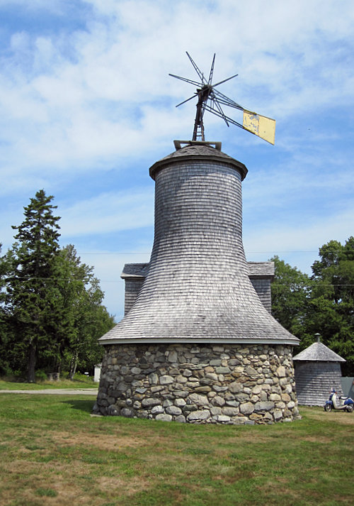
The Minister’s Island windmill
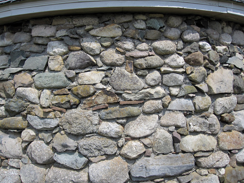
The windmill is constructed from beach stones

The Minister’s Island garage

* Ferguson, L., and L.R. Fyffe. 1985. Geological Highway Map of New Brunswick and Prince Edward Island. Atlantic Geoscience Society Special Publication No. 2.
© Graham Young, 2019
Ghost Streams on the Shore
Saint Andrews, New Brunswick: August, 2018

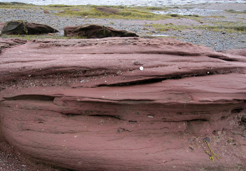
Beds of the Perry Formation in Pottery Cove, Saint Andrews, New Brunswick.
Rocks are physical ghosts. If a ghost is a disembodied spirit or a nebulous image of a deceased person, bedrock is a concrete relic of the lost place and time in which it was formed.
Geologists and non-geologists, we each interpret rocks in our own way. Those of us who like to collect may get excited about sedimentary rocks as hosts for fossils. The fossils can tell us a lot about past life, but the rocks themselves are packed with information about the places in which those creatures lived. Geologists who know how to read the clues hidden in the ancient sediments can use that information to interpret the rock’s specific facies, a proxy for the environment in which it formed.
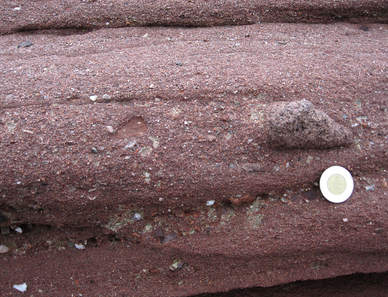
A sandstone bed in the Perry Formation exhibits a great variety of clast sizes.
I find sedimentary rocks particularly striking when they are located in a setting where they superimpose a long-past environment onto a modern one. Sometimes these are surprisingly similar to one another, as described in a previous post. In other instances such as the one shown here, the past and present are remarkably different, yet they exist harmoniously together. At Saint Andrews, we can observe the ghosts of ancient fast-flowing streams as we stroll on the peaceful modern seashore.

We each enjoy and interpret the shore in our own way.
In the Passamaquoddy Bay area, where New Brunswick (Canada) and Maine (USA) meet, a predominant bedrock unit is the Upper Devonian Perry Formation, which is roughly 360-380 million years old. The Perry Formation is unusual because it possesses two very distinct and contrasting personalities. Much of the formation consists of sedimentary rocks: striking red sandstones, siltstones, and conglomerates such as those shown here. Yet the Perry Formation also has a dark side: it includes grey basalts, formed from the cooling of molten lava; I will show some of these in a later post.
Cross beds in the Perry Formation demonstrate that the sediment was deposited by flowing water.
The modern coast at Saint Andrews is a gentle and civilized setting, with a lushly treed ridge sloping down to a shore where the flow of the St. Croix estuary meets the more open waters of Passamaquoddy Bay. But in the Devonian this was a very different place. The Perry Formation almost lacks fossils (plant fossils are found in a few places), but the story in the rocks tells us about streams and alluvial fans on a valley floor between tall new mountains, which may have still been rising in the mountain-building event that geologists call the Acadian Orogeny.
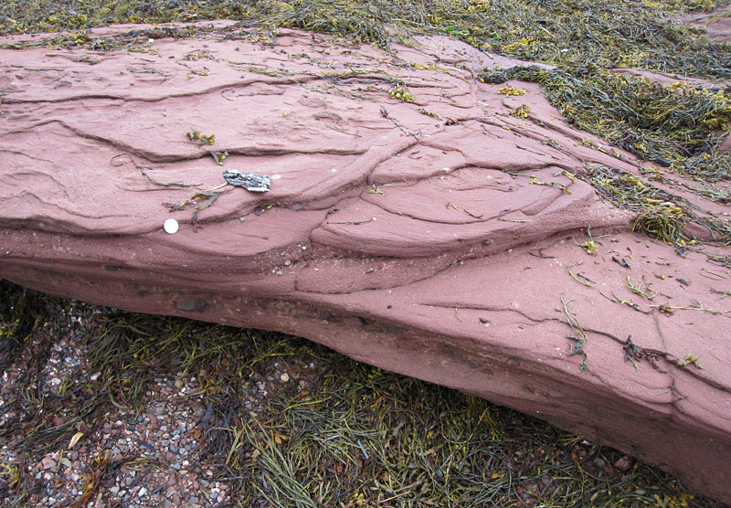
Trough cross beds have curved bounding surfaces and are of limited extent.
Geologists have studied features of the Perry Formation, such as the directions of trough cross bedding, channels preserved in the rock, and pebble imbrication (the alignment and overlap of ancient pebbles in the stone). From these studies, they can determine paleocurrent directions, teasing out data from the sandstones, pebbly sandstones, and conglomerates to determine that ancient streams and rivers flowed from north to south out of those long-ago mountains.

In some places there are so many large rounded clasts that the rock could probably be called a conglomerate. The abundant large rock fragments in the top of this bed indicate that the sediment source was nearby.
It makes sense, therefore, that the main source of sediment was to the northwest. The sedimentary rocks become quite coarsely conglomeratic toward the north, and the sediment source was not an immense distance away. Although there was so much geological activity in the Passamaquoddy area in the Devonian Period, the Perry Formation sediments remain near the original dip angle at which they were laid down, evidence that there has been very little mountain-building around here in the past 350 million years or so!

Information about the Perry Formation can be gleaned from many geological sources. Here are a few of them:
Greiner, H. 1978. Late Devonian facies inter-relationships in bordering areas of the north Atlantic and their palaeogeographic implications. Palaeogeography, Palaeoclimatology, Palaeoecology, 25: 241-263.
McIlwaine, W.H. 1967. Age and origin of the Perry Formation, Charlotte County, New Brunswick, Canada. Atlantic Geology, 3(2): 56-60.
Schluger, P.R. 1973. Stratigraphy and sedimentary environments of the Devonian Perry Formation, New Brunswick, Canada, and Maine, U.S.A. Geological Society of America Bulletin, 84: 2533-2548.
Smith, G.O. and D. White. 1905. The geology of the Perry Basin, southeastern Maine. United States Geological Survey Professional Paper No. 35, 107 p.
Stearns, C. and R. Van der Voo. 1987. A paleomagnetic reinvestigation of the Upper Devonian Perry Formation: evidence for Late Paleozoic remagnetization. Earth and Planetary Science Letters, 86: 27-38.
© Graham Young, 2018
Leaving the Sea Behind
La Pocatière, Québec: August, 2018
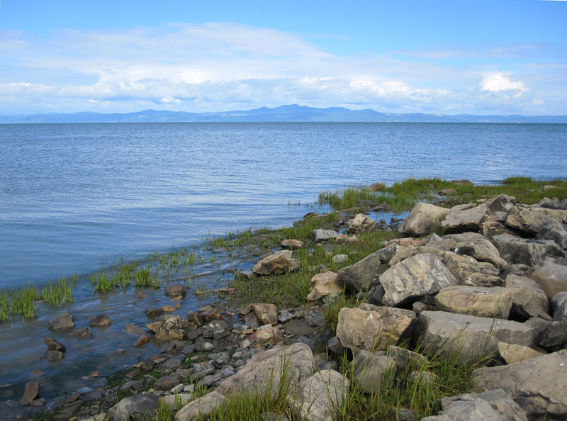
On any trip to the coast, there will always come that day when we must leave the sea behind us, catching the last glimmer of blue water in the rearview mirror as we steel ourselves for return to a fully land-bound existence. This summer, our “last chance to sea” came at the salt marsh park of La Pocatière, Québec.
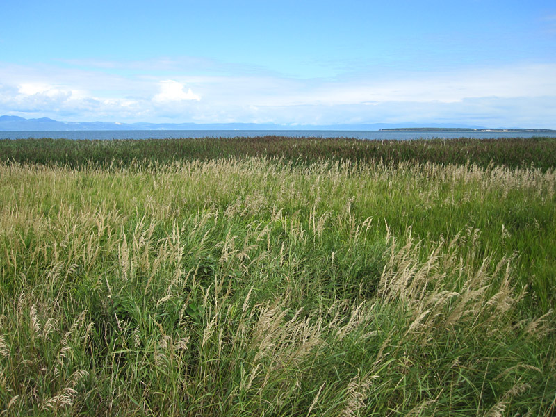
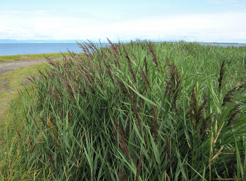
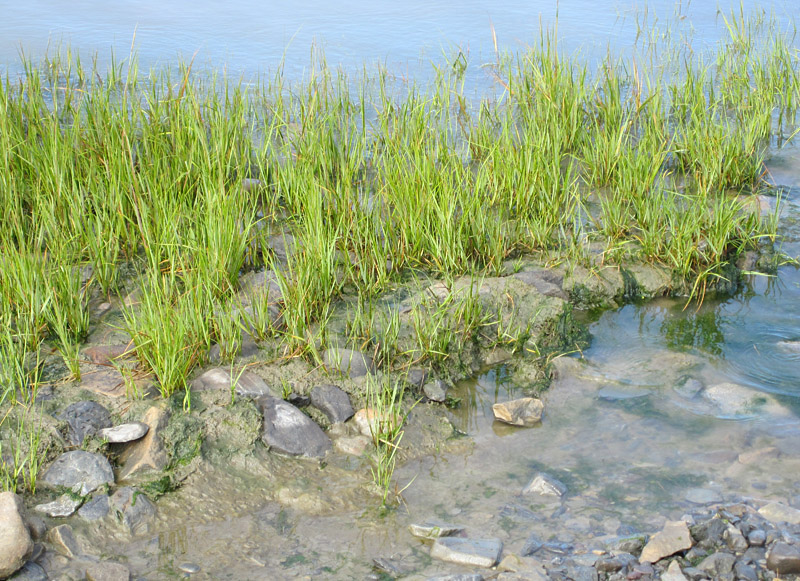
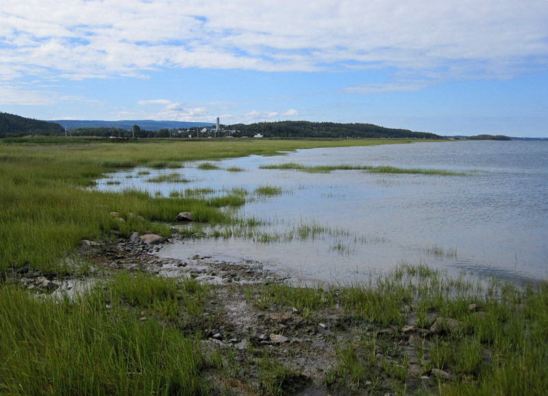
Zoned bands of grasses in the salt marsh lead to the sea.
La Pocatière is a most appropriate place for this: the broad St. Lawrence estuary is narrowing here and becoming fresher, in comparison with downstream shores around Cacouna or Trois-Pistoles. Still, the salinity is at about 15 parts per thousand, almost as salty as some parts of Hudson Bay and far more salty than the Baltic Sea, so we can definitely say we are still “by the sea.” Also, the shore here is characterized by a Spartina (cordgrass) dominated marsh, and it is lovely.
The grasses and other plants occur in distinct bands of colour, their growth affected by distance from the river and its salinity. They could not appear more artistic if they had been arranged by human hand.
And speaking of artistic arrangement, the man-made part of this shore features art installations, which change every year. The installations speak to the relationship between people and this natural setting, and they gently weather as they are affected by sun, wind, water, and salt.
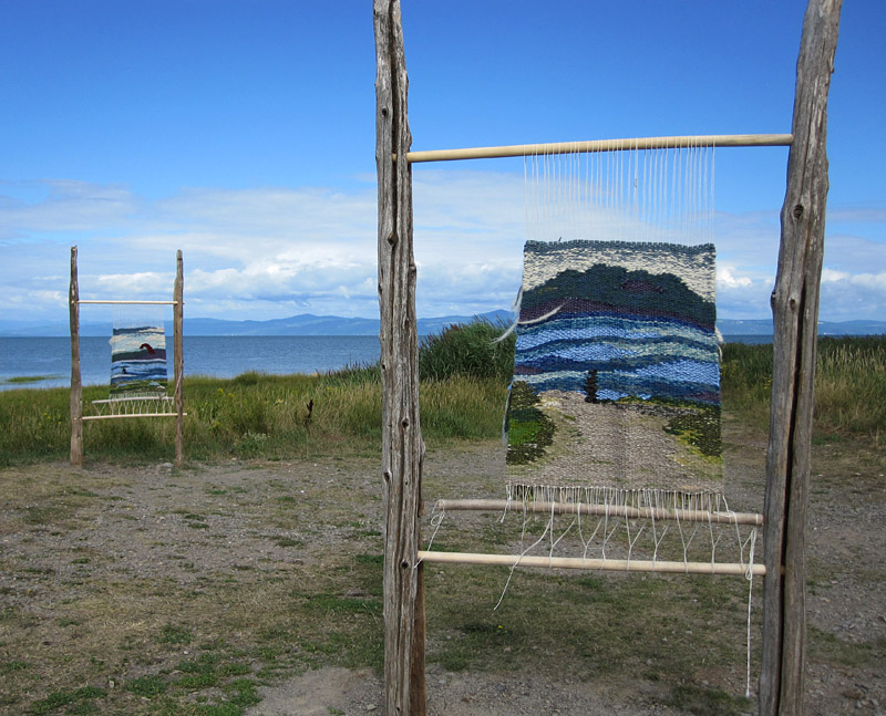
Each year, the park at La Pocatière features a different set of outdoor art installations. This year, it was these “coastal” woven pieces.

A few years ago, there were these fantastic fishy forms.
One last glance, then we must start the motor and continue our drive westward. Perhaps we can find some fabulous Québec ice cream to assuage our sadness.
© Graham Young, 2018
A Certain Logic
Churchill, Manitoba: August, 2015
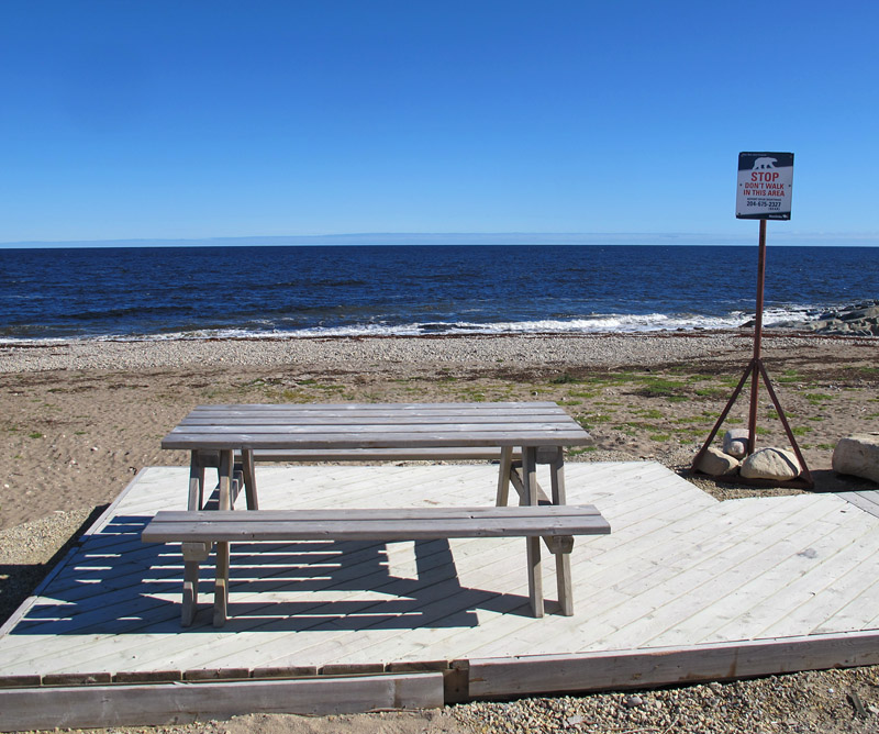
The careful juxtaposition of the picnic table and sign must have required a very special sort of thinking. You are in danger if you walk in this area, but yes, it would be just fine to have a picnic. Please don’t forget to bring sardines for the bears. Polar bears like sardines.
© Graham Young, 2017
Going to Pieces on the Shore
Indian Point, Saint Andrews, New Brunswick: July-August, 2017
The tide is still going out. Off the point, the gulls squabble among themselves in the wake of a passing boat. A guillemot floats on the swell much farther offshore, its white wings bright against the black body. You turn just in time to see the osprey flap past, flying low with a heavy fish in her claws as she labours toward her nest on Navy Island.
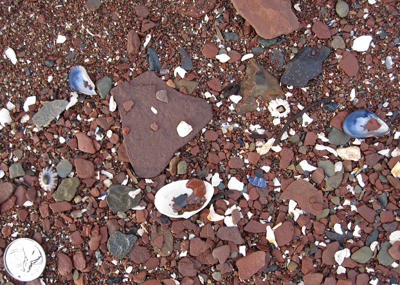
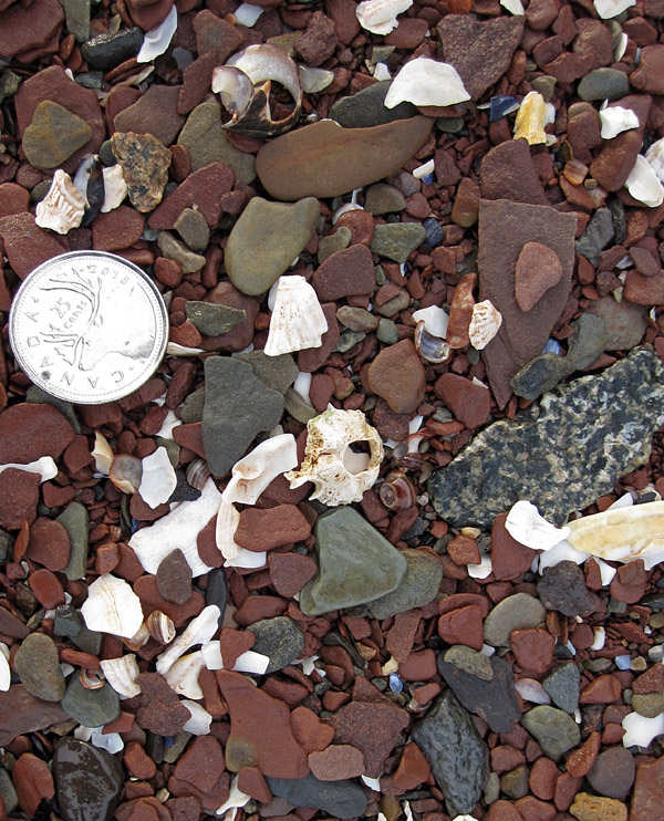
Clam, barnacles, and mussels (coin diameter is 24 mm)
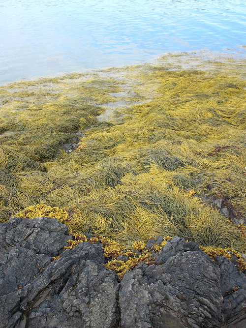
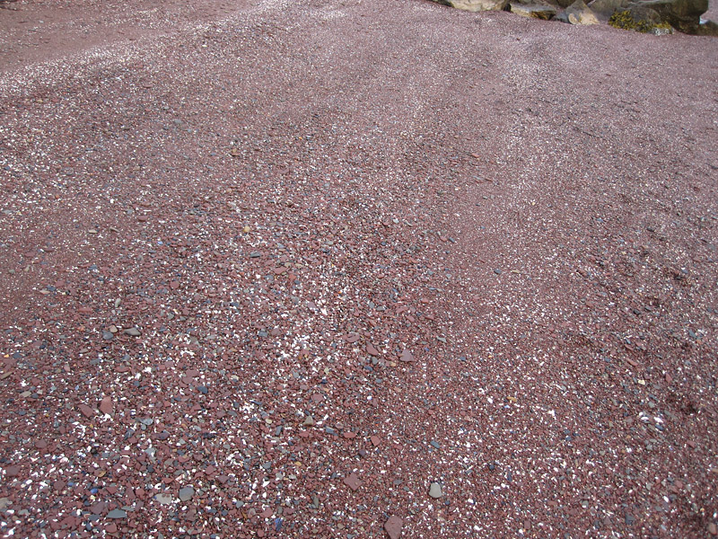
Looking between your feet, you notice a few shells: clams, mussels, barnacles, periwinkles, the occasional crab carapace. They show white, brown, and blue against the gravel that forms this beach. The gravel is red, a beautiful deep ochre flecked with grey, black, and white. The red comes from pieces of the same old sandstone that forms the bones of this point. The grey and black are clasts of other rock: basalt, schist, and granite.
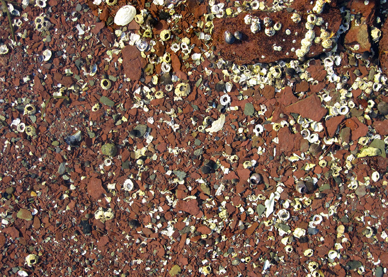
But what are those white grains interspersed through the gravel? They seem to be bits of shell – yes, crouching to look more closely, you can see clearly now that some of them are angular bits of clam, some are mussel shell bleached to pale lavender-white, and some might be particles of periwinkle. Others are odd – some of the most abundant are weird wavy pieces, and your best guess is that they are remnants of disintegrated barnacles.
Going to pieces: a gastropod (at top) and barnacle (centre) are slowly being broken down into the sorts of shell fragments that surround them (coin diameter is 24 mm).
There must be hundreds of shell fragments, possibly thousands, in that two-metre-square in front of you. Why are there so many bits of shell here, when there are only a few complete shells in the same area? The answer lies in that red gravel. To break up so much sandstone bedrock into little bits of gravel requires the application of considerable force over a substantial interval of time. That force was supplied by waves and currents, driven by wind and that twice-daily tide, day in and day out over seasons, years, and centuries.
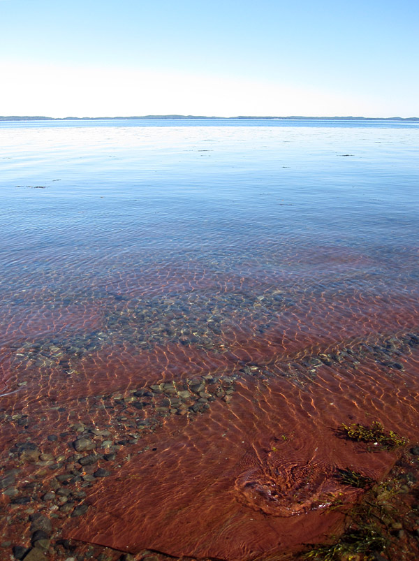
Sandstone forms the bones of the point.
In winter, the ice and frost do their bit to break up rock and speed up the process. If you have been here during a big storm, you will have heard a deep roaring and grating, like the growl of a cement mixer projected through an arena-scale PA system. That is the sound of grains and cobbles grating on one another and on the bedrock of the point . . . and that really speeds up the process.
The same thing happens to the shells. The rich environment of this shore hosts huge numbers of molluscs and crustaceans, and as they die their shells are moved by the waves and currents, some of them transported into the swash zone where the water’s energy can really do its work. The white fragments you see here were all parts of the shells around living creatures – probably not very long ago given the power of the sea in this area, though of course it would be difficult to tell for sure without some rather detailed study.
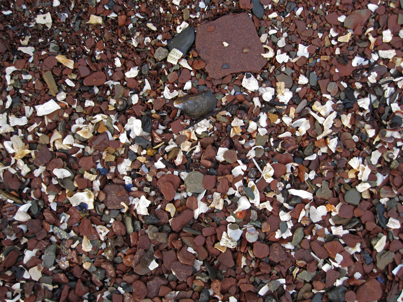
Variations in shell content help to create the bands of colour in this beach.
Standing up, you wander slowly along the shore. You see that shells and shell bits are everywhere that there is sediment, but the assemblages are made up of different kinds of shells as you move along the beach, and they are much more abundant in some areas than others. Here, the gravel is full of barnacles and barnacle bits. There, a tidal channel is packed with periwinkles, the living crawling over living and dead. In some places there are many complete shells, and in others it seems everything is broken.
Barnacles galore . . .
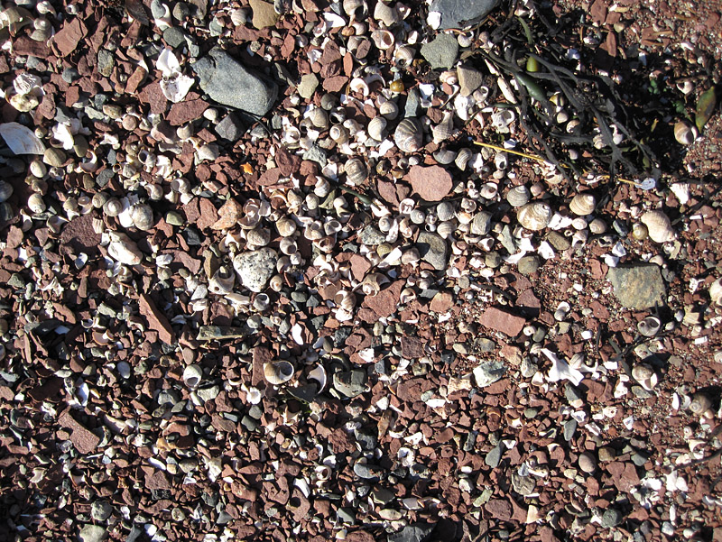
. . . and periwinkles everywhere.
Let’s walk up the shore now and stand on the low bluff. Looking down across this modest area of beach, how many shells and fragments are visible on the surface in front of us? Millions? Now consider that this beach sediment could have a depth of many metres, and it disappears where it slopes beneath the rippling sea.
Consider further that this beach also disappears from sight around the point to our left and right – but we know from experience that we might see similar shell-laden gravels if we drive to other shores around Passamaquoddy Bay, and if we drive hundreds or even thousands of kilometres along the coast in either direction, we might well get out of our car and find comparable sediments.

Beyond town, we can find more and different shells near the St. Andrews blockhouse.
On all the world’s coasts, the shells of molluscs and crustaceans occur in uncountable, utterly mind-boggling numbers. Counting them would be, literally, like counting the grains of sand on a beach or the stars in the sky. An examination of the geological record indicates that similar shelled creatures have been donating their remains to coastal deposits for more than 500 million years, contributing very significantly to the volume of sedimentary strata (and, incidentally, allowing immense amounts of carbon to be sequestered in the rocks). The scale of this invertebrate sedimentary contribution is entirely astounding; it is as big and as difficult to comprehend as the extent of geological time. Yet most of us, even many geologists, think about it not at all.
© Graham Young, 2017
What Geologists Share: Fieldwork and the Four Dimensions
If you visit this page occasionally, you will have noticed that I have posted very little since last spring. This interval correlates rather precisely with my term as President of the Geological Association of Canada. I have discovered that it really isn’t possible to be both an active blogger and an active officer of a national organization, and since the term of the president is just one year, I have been focused on that. As president, I am at least able to write articles for the GAC’s member newsletter, Geolog; this piece is reprinted here by permission.*

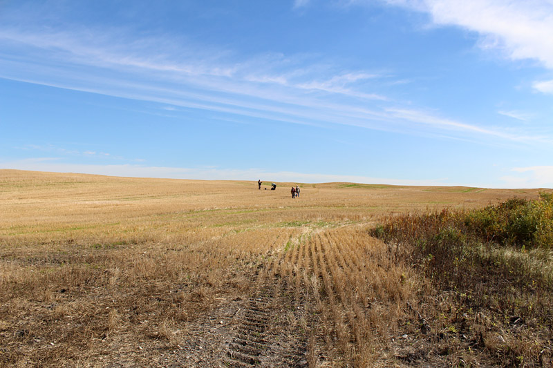
Geological field party near Sloop Cove, Churchill, Manitoba: August, 2015
A few weeks back, during the golden days of early autumn, I did some collaborative field research in southwest Manitoba with colleagues from the Manitoba Museum. Spending field time with people from other disciplines, I began to consider our different thought patterns, patterns that have developed as a result of experience and training.
The zoologist was driving our van, but he was constantly scanning around for creatures as he drove. He could recognize the species and gender of a bird in flight before I could even see the bird, and he counted dozens of red-tailed hawks during a morning where I noticed maybe four of them. He detoured around snakes on the road and then stopped to ascertain their species, age, and sex.
Museum field party near Belmont, southwest Manitoba: September, 2016
At a prehistoric bison kill site, the archaeologists could talk about the season of a hunt hundreds of years ago. They could envision the behaviour of people who drove the bison over a ridge and into a kill zone in the low wet rushes. We could see bits of bone everywhere, but they could find tools, know how the tools were made, and understand how the people were living and what resources they used. To me, it seemed like each of these non-geologist experts had their own “super power,” a quality that was beyond the ability of mere mortals.
As time progressed, I realized that we geologists also have our own super power. As we looked at older geological sites, it was striking that those of us doing geology could see things that our colleagues could not. Our background allowed us to readily place a series of long-past events in chronological order, and to “see” those events in the context of other things happening around them. We could see how the small modern Souris River sits in a valley that was eroded by much larger floods from the outflow of ice-dammed post-glacial lakes; high in the valley wall, those flows had cut through sediment deposited previously by a glacier, which had itself transported materials from the Cretaceous shales that sit lower in the valley. We could recognize this sequence, and we could keep the events and their locations in order in our heads; from their comments, our non-geologist colleagues clearly had a difficult time with this.
Banks of Cretaceous shale along the Souris River, southwest Manitoba: September, 2016
During many summers I have done fieldwork in the Churchill area of the Hudson Bay Lowland, and in 2014 and 2015 I worked there with groups of geologists that included people far outside my area of expertise. I am an invertebrate paleontologist, but these field parties included regional stratigraphers, sedimentologists, a petroleum geologist, and a Quaternary geologist. We certainly did not understand the details and technical terminology associated with one another’s specialties, but we all seemed to readily follow the other people’s thinking and arguments.
I have taken part in many other geological field trips, and geologists never really seem to have trouble crossing boundaries between one specialty and another. It seems that, at some point, most geologists have learned to apply similar logical thinking to a variety of geological settings and subjects (and this even holds true for those of us who started off in disciplines other than geology). The fact is that we all share a set of general principles: the geological time scale, uniformitarianism, the rock cycle, erosion, weathering, the law of superposition, the law of original horizontality, and the application of Occam’s Razor to our field observations. Walking around in the world, we all carry this basic information as a toolkit, and as a result we can see what other geologists are talking about, whether they are structural geologists, paleontologists, or geophysicists.

Dave Rudkin of the Royal Ontario Museum acts as polar bear guard for a group of geologists at Bird Cove, Churchill, Manitoba: August, 2015.
Field experience is absolutely critical to this understanding. At some stage we have all had to consider the world as a four-dimensional place; we look at the three physical dimensions of each geological site, considering what we can see on the surface and interpreting how it is likely to extend below that surface, but we are also constantly interpreting the changes through deep time that have produced what we see today. We visualize how overlying or crosscutting features can be teased apart to find the likeliest story. Basic geological field research, considering a variety of rocks and settings, gives all of us at least a modest understanding of the breadth of geology. It emphasizes to us that basic principles are important, and it encourages our interest to such an extent that many of those principles become fixed in our brains.
I am, however, concerned that geology is in some danger of losing that breadth. We hear so often now that we need to be teaching students to do very specific tasks, so that they will be trained for particular technical jobs – they need to know how to use very complicated and specialized equipment, how to log core in certain standard ways, how to carry out standardized studies that lead to particular defined research goals. This is important – there is no question that people need to make money and have careers, that our economy requires skilled and talented scientists, and that we constantly have a need for particular resources or that certain sorts of environmental problems must be solved.

Using complicated or specialized equipment: me with a quarry truck, which we had contracted for some “serious collecting” near Churchill, Manitoba: August, 2016.
The danger in becoming an entirely “job-trained” modern discipline, though, is that we could also lose the vision that might allow us to solve future problems that we don’t yet even recognize. And the pursuit of very applied and directed work is likely to mean that scientists ignore anything they observe that was not included in the original workplan or grant proposal.
Lately, I have been reading some of the Geological Survey of Canada Reports of Progress that documented 19th century scientific exploration of Canada (I could say geological exploration, but many of them are so much more than that). Almost every field scientist employed by the GSC seems to have been a talented polymath, and as they carried out fieldwork in previously unexplored territory, they didn’t just look at geology. They observed and tried to understand everything, making incisive and generally accurate interpretations on the fly while canoeing many miles a day through often-hostile wilderness, collecting samples, mapping, and sometimes producing landscape paintings or photographs before sleeping under canvas. And then they did it all again the next day, and the day after, through the entire summer, perhaps making it back to “civilization” after the first snows of autumn.
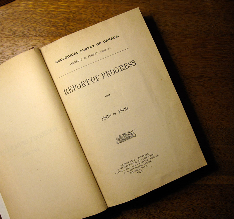
Those GSC scientists were, of course, given the task of locating and documenting deposits that might have economic importance. In the report for 1869, for instance, Robert Bell assessed silver resources along Lake Superior and Lake Nipigon, Ontario (Bell 1870), and Charles Robb noted molybdenum deposits in central New Brunswick, an area where mine projects are still being developed today (Robb 1870). While they were doing this, they also considered other questions they had been assigned, such as Bell’s discussion of where the transcontinental railway might be located in the area around Nipigon.
At the same time, the GSC field geologists documented many phenomena that had no obvious economic significance, simply because they were there and might become important in the future. The remarkable reports of J. B. Tyrrell hold many examples of this, such as his description of the Cedar Lake amber locality in Manitoba (Tyrrell 1892). Bell (1880) and Tyrrell (1897) both considered glacial geology as they spent time in the area around Churchill, Manitoba; this topic was far from most of their other geological work, but both made significant contributions to the development of ideas on postglacial rebound.
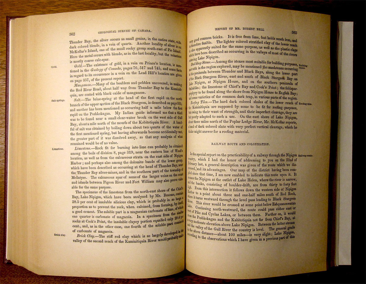
Pages from Bell’s report on the Nipigon district (Bell, 1870)
These 19th century GSC geologists showed such remarkable drive, ability, stamina, and creativity, that most of us in the modern world are really just faint shadows by comparison. We may not be able to duplicate their energy, and the administrative and bureaucratic demands of the modern scientific world mean that we will never be permitted to have their focus, but we can still emulate their broad curiosity about all of geology and related disciplines.
As a museum curator, I feel very fortunate that many geologists do maintain this broad view of the world, since so much material in museum collections has come from such scientists. For example, a mining company geologist working with a drill crew in the Grand Rapids Upland was looking for an ore body, but was also interested in regional geology. I cannot speculate on what they found in terms of nickel and other metals, but he made an important paleontological find: he generously passed along to my colleague at the Manitoba Geological Survey that there were eurypterids (sea scorpions) in the Ordovician rocks in this area, and she in turn passed that along to me. As a result, we were able to go and scout in that same area, finding the site that hosts the strange and significant William Lake biota (Young et al. 2012).

Debbie Thompson (R) and me, carrying out paleontological field research at Airport Cove near Churchill: August, 2016 (photo © Michael Cuggy).
As we travel around our country and the world, it is incumbent on us as geologists to always be using those tools that our training has given us. If it is my job to search for fossils, that doesn’t mean that I should be ignoring folds or minerals, just as a mining company geologist should not ignore the landforms beneath which an ore body might lurk. There are never enough of us in any one discipline in this huge land, and we all benefit if we are each considering the entire science as we travel around, not just our own little piece of it.
As a science, we always need to collaborate, to think of our colleagues, make use of our networks, and pass along any information that could be useful to someone else. This is, of course, a major reason why the GAC exists, and why our annual GAC-MAC meetings are so critical to the continued health of our science in this immense country. The geological integration of time and space is our super power. Let us use it wisely!
References
Bell, R. 1870. Report of Mr. Robert Bell on Lakes Superior and Nipigon. Geological Survey of Canada, Report of Progress for 1866 to 1869, pp. 313-364.
Bell, R. 1880. Report on explorations of the Churchill and Nelson rivers and around God’s and Island lakes. Geological Survey of Canada, Report of Progress for 1878-79, pp. 1C-68C.
Robb, C. 1870. Report of Mr. Charles Robb on a part of New Brunswick. Geological Survey of Canada, Report of Progress for 1866 to 1869, pp. 173-209.
Tyrrell, J. B. 1892. Report on north-western Manitoba with portions of the adjacent districts of Assiniboia and Saskatchewan. Geological Survey of Canada, Annual Report, Volume 5, Part 1, pp. 1E-235E.
Tyrrell, J. B. 1897. Report on the Doobaunt, Kazan and Ferguson rivers and the north-west coast of Hudson Bay and on two overland routes from Hudson Bay to Lake Winnipeg. Geological Survey of Canada, Annual Report of 1896, Vol. IX, Part F, 243 pp.
*A version of this essay was originally published in Geolog (Vol. 45, No. 3, 2016), the quarterly newsletter of the Geological Association of Canada.
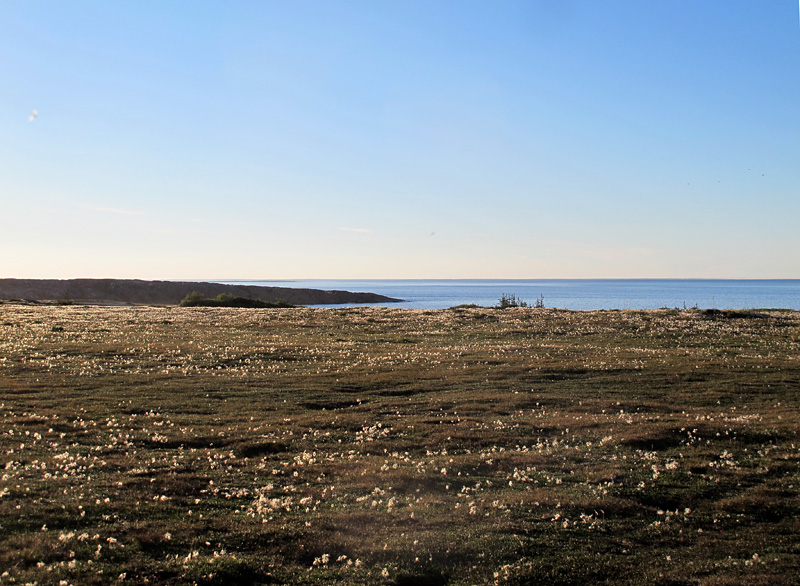
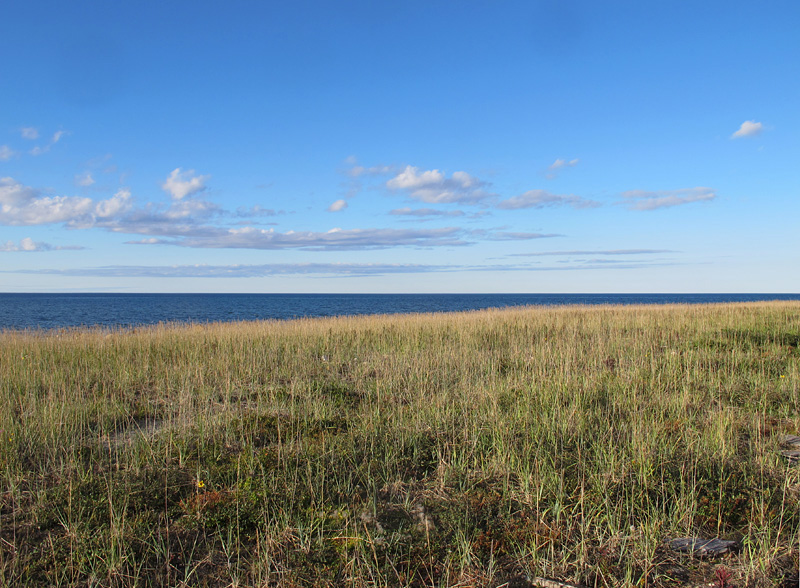
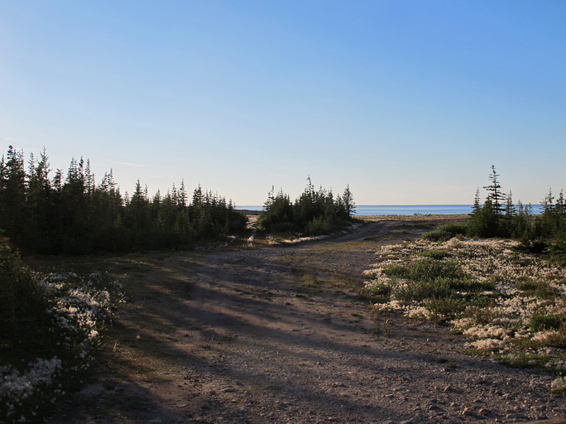
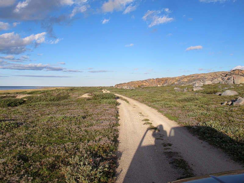
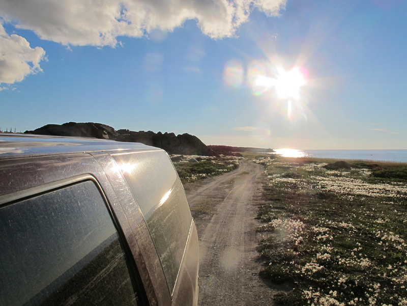
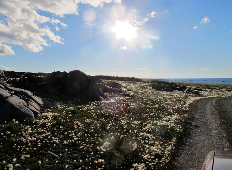
Golden Hour at Churchill
Scenes from Northern Summers (5)
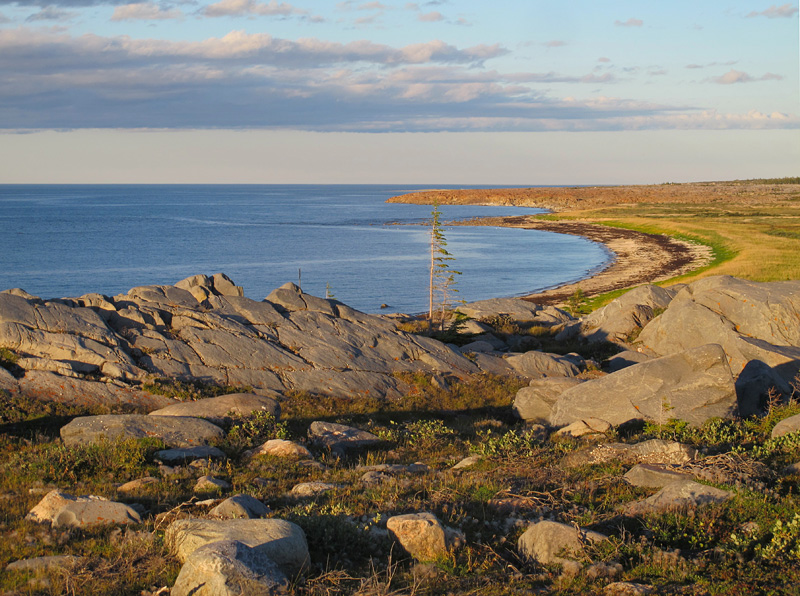
In photography, “golden hour” is the interval just before sunset or just after sunrise, in which photographs are enhanced by the low angle and golden quality of light. Churchill, Manitoba, is a place where it is almost impossible to take a bad photograph, due to the sculptured, variable landscape and diversity of interesting life forms. Put golden hour and Churchill together, and even those of us with modest photographic skills can manage a few decent images. These photos were taken last night; we are in Churchill for paleontological field research, which has also been successful!
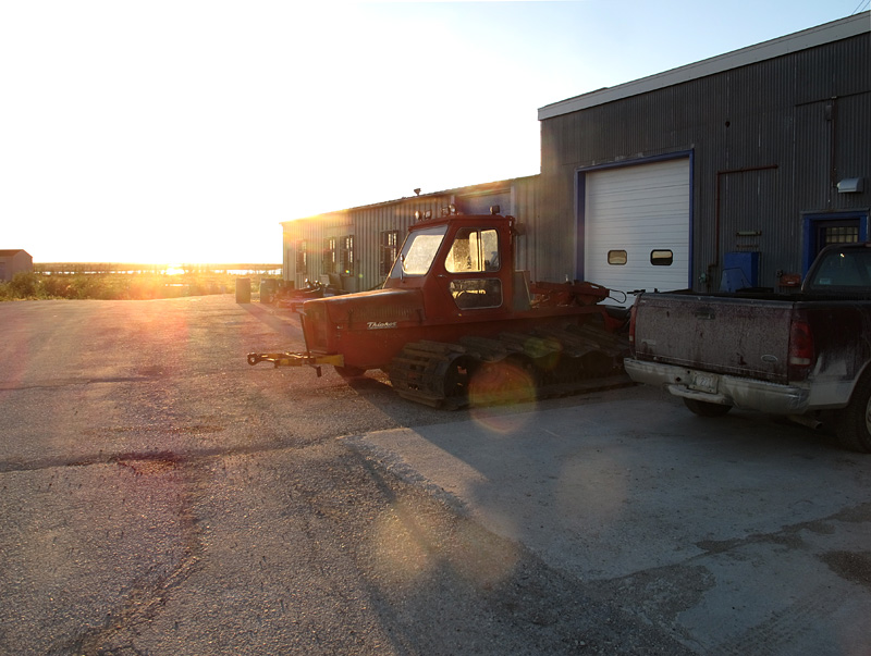
A Thiokol snowmobile outside the Churchill Northern Studies Centre. This is clearly a remnant of US involvement in the Churchill rocket range; I wasn’t aware that the company that made rocket motors also produced snowmobiles!
© Graham Young, 2016
Meditation at 20,000 Feet
The following is lightly edited from notes written last week, as I travelled westward on a flight from Fredericton to Toronto.

Across northern Maine and southern Québec, those ever-changing landforms are ghosts and memories. We cannot say that the Earth remembers everything that has ever happened to its surface – it has forgotten far more than it remembers, but it remembers a lot.
Every one of those features below us has a memory to tell, the story of how it was formed and how it changed through time – some of them are rich memories, full of detail and arc of story. Others are faded wraiths: you might just make them out if you look at them out of the corner of your eye, but they disappear when looked at straight on or in bright sunlight. Perhaps the dark arts of remote sensing, isotope analysis, and X-ray diffraction will divine their stories, but they hide their secrets deeply.

Wind generators on the Appalachians, along the Québec-Maine border near Lac Mégantic
So many features, and so many of them are scars. Earth has had a long history of damage and injury – some of the injuries have come from outside, but some have been self-inflicted. Poor thing, our old Earth. We need to understand it better and treat it far better.
Walking with my brother earlier today, we compared injuries and war wounds – a chronically sore ankle here, an arthritic hip there. We commented that the human body might appear to heal, but it still carries the scars and damage within itself. That damage can rear up and reveal itself at some later date – if we had known what we know now, we would have been more careful decades ago when we hurt ourselves.

Lac Mégantic
Earth is like that, too: many of its scars are not obvious to most of us. Those Appalachians we just passed over are one such scar – they tell us how tectonic plates crashed together oh so many years ago (starting about 480 million, actually), when Laurentia, the ancestral heart of North America, began to push into the crust of the ancient Iapetus Ocean (the continuation of this would eventually lead to the formation of Pangaea, as Laurentia pushed into northern Africa). In the process, Earth’s crust was buckled and pushed up into mountain ranges that, at their highest, may have been as tall as the Himalayas are now. Even Mount Katahdin, at a full mile high (including the cairn on top), is just a low remnant of those mountains. What happened to them? Earth may have self-harmed through plate tectonics, but it has been self-healing ever since through the use of weathering and erosion.
Earth started self-harming early on, apparently as a result of poorly resolved heat issues deep within. Plate tectonics began billions of years ago. The plates slowly move from one self-inflicted scar to another; the new crust rises at spreading centres (divergent boundaries) such as the mid-Atlantic Ridge, and crust is subducted and melted at convergent plate boundaries such as that along the Aleutian Islands. The scars are long and jagged, extending all around the planet’s face.
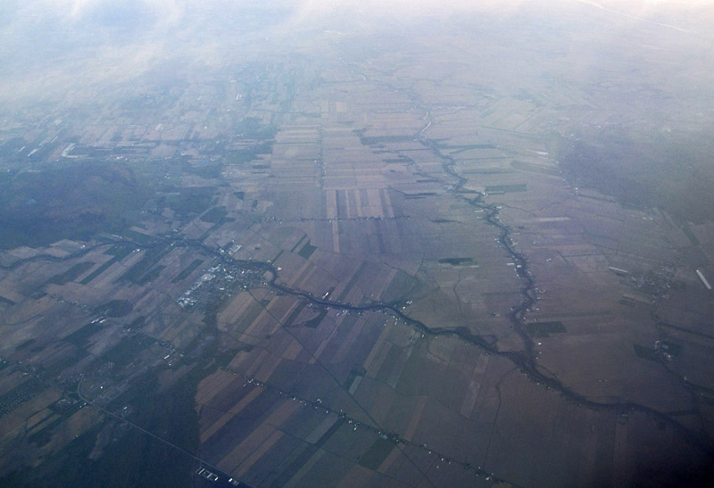
The sediment of the Saint Lawrence Lowlands plain is cut by rivers. Note the characteristic Québec field pattern, with long narrow fields extending away from the waterways.
You might argue that Earth is not really self-harming, that plate tectonics is nature’s course, and just the way a planet has to be. But other terrestrial planets aren’t like this. They have managed to grow up without plate tectonics (like Mars?), or they may have experimented with plate tectonics in their early years (like Venus), but later outgrew this juvenile deviance.
And sure, Earth self-harms, but at least that self-harm prevents it from showing many scars of external violence, unlike the Moon and Mars. All these bodies have been bombarded by meteorites, comets, and other space debris, most notably in their formative years – they all had a tough childhood. Earth’s self-harming may have allowed it to overcome that childhood damage – the scarring from plate tectonics effectively hides most of the pitting and damage from that external violence, except for a few places like the Manicouagan crater (which isn’t all that far to the northeast of us here).
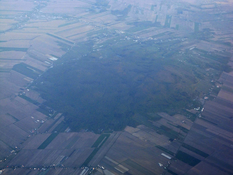
Mont Rougemont, rising out of the Saint Lawrence Lowlands, is one of the Monteregian Hills. These igneous hills, which include Mount Royal and mont Saint-Hilaire, were formed as North America slid over a “hot spot” during the Cretaceous Period.
Now we are out over the flat Saint Lawrence Lowlands. We could consider this sort of sediment-covered plain as being a “fully healed” patch of the Earth. The sediment has accumulated on and off over the past 500 million years or so. It blankets and hides the far less regular terrain beneath, including Logan’s Line where Appalachia and the Canadian Shield butt up against one another. Even below all that sediment is a scar that has never quite healed, as evidenced by the earthquakes that have occasionally struck Québec during the past few hundred years.
But wait. I can see some fresh wounds down there. Erosion never sleeps, and those valley sediments, even the relatively recent ones deposited under the Champlain Sea some 10,000-13,000 years ago, are cut by fresh narrow rivers that knife through the surface and carry away the clay and soil.
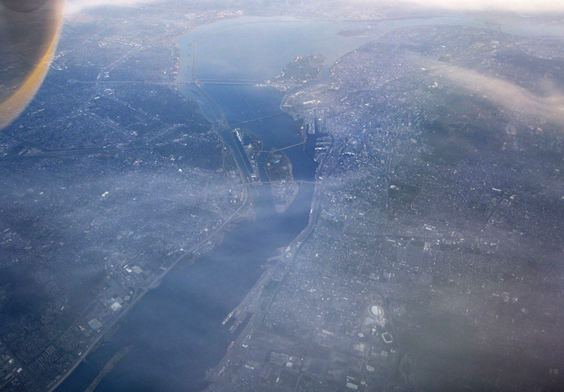
Montreal and the Saint Lawrence River
Flying over Montreal, we see some of the most recent of Earth’s cuts and scars. But these are not self-caused; rather, they come from a parasitic infestation. The deep slicing of the St. Lawrence Seaway, the piling of stone on the side of Mount Royal, the piercings constituted by the Lafontaine Tunnel: these are not Earth’s own doing.
Will Earth’s scars and damage ever heal? With enough weathering and erosion, all those hills would be flattened, rock fragments and clay would be transported away by rivers, and the entire surface of the planet would be a nearly level plain, probably located somewhere below sea level. But fortunately for all life, that won’t happen, because there is no evidence that Earth will ever cease self-harming. Even as I write this it is creating new crust along the ocean ridges, and pushing the Himalayas just a little bit higher. We can rest secure in the knowledge that tectonism never sleeps.
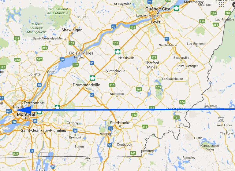
The blue arrow shows the approximate route of the plane over southern Québec. (based on Google map)
© Graham Young, 2016