Premium Real Estate
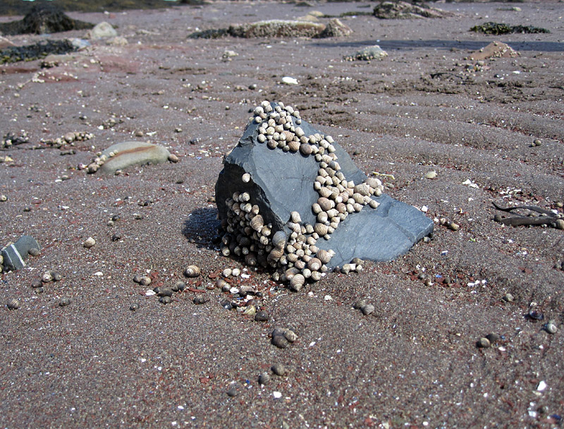
Periwinkles on a basaltic boulder
Those of us who study the ecology of long-extinct marine creatures have to work from clues: the morphologies of the fossilized organisms, the character of the enclosing sediment, and the preserved spatial relationships between fossils in bedrock. It is always pleasing to see modern examples that support our interpretations of ancient life. These photos from the shore of Passamaquoddy Bay show some very nice examples of the way in which many organisms need solid substrates.
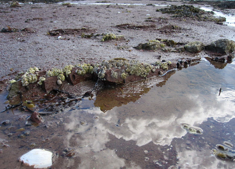
Barnacles on sandstone bedrock
In some sedimentary rocks formed on muddy or sandy seafloors, such as Manitoba’s burrow-mottled Ordovician carbonates, we often see fossil corals that had grown on top of other corals, corals that had grown on top of stromatoporoid sponges, and sponges that had grown on corals. In interpreting these we generally state that the distribution of the fossils was governed largely by the rarity of hard substrate. If the seafloor was covered with firm sediment, then the coral or sponge could have grown directly there. But if the seafloor was composed of soft or shifting sediment, then an organism there could not remain in a stable position, and it was only those that found firmer substrates that were able to survive. Thus, we see the corals and sponges that had grown on other corals and sponges, as those were the only hard surfaces around (whether the overgrown creatures were alive or dead at the time is a whole other avenue of inquiry).
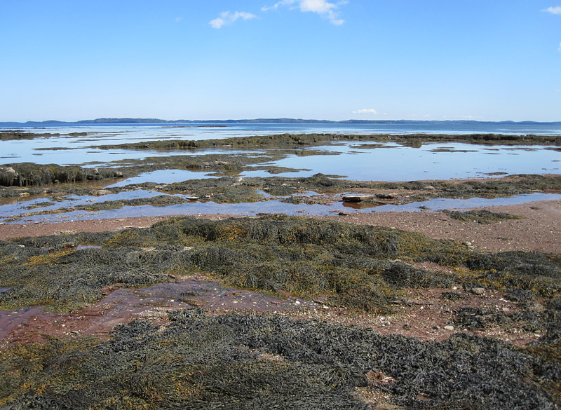
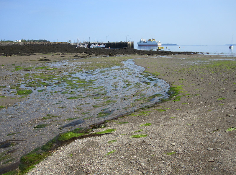
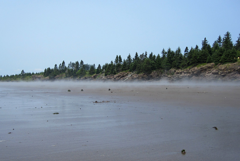
The Saint Andrews shore, with Deer Island on the horizon
An Embarrassment of Riches
World Water Day, 2016

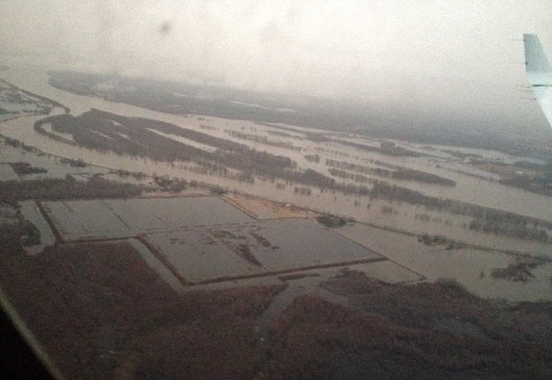
From a helicopter, the tundra ponds in Manitoba’s Hudson Bay Lowlands are countless.
As World Water Day draws to a close, here are a few images illustrating a fraction of Canada’s immense store of fresh water. World Water Day brings to the fore humanity’s concerns about fresh water, health, and environment. Canadians need to be far more aware that Canada holds about 20% of the planet’s freshwater resources; this water is critical not only to our population and industries, and to our marvellous wilderness and ecosystems, but also to the global environment.
These photos were all taken during my travels in the past year.
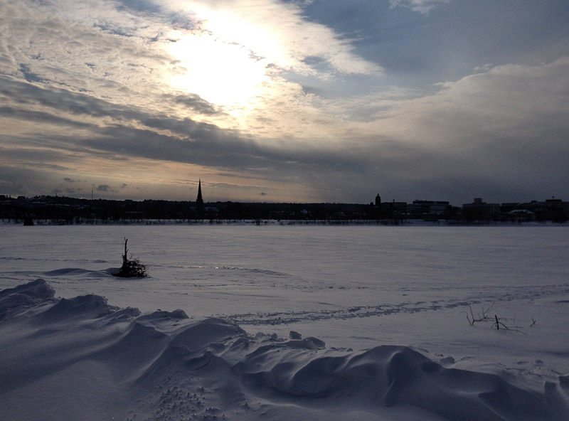
New Brunswick’s Saint John River changes dramatically from season to season. In Fredericton in the dead of winter, it is a sahara of snow . . .
. . . while during spring freshet the river below Fredericton fills most of its valley . . .
I haven’t been around here much lately because . . .

. . . we have been very busy at the Museum for the past few months, and much of this busy-ness has been associated with preparing exhibits about a spectacular Cretaceous pliosaur (plesiosaur) skull that we acquired a couple of years ago. Much of my own work on the project has been more on the “paper” side of things (researching and writing the exhibit panels, working on grant proposals and budgets), but other staff at the Museum have been doing some fantastic hands-on work, and you might be interested to look at the story and photos of the skeleton mount work on my museum page.
Up a Hazy River
Fieldwork in the Hudson Bay Lowlands, August 15, 2015
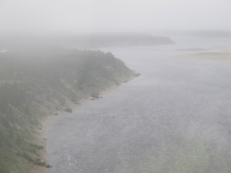
A grey, chilly morning at the Churchill Northern Studies Centre had us considering the weather. This was to be the last of our three “helicopter days” for 2015, so we really wanted to be out there over the horizon. But the weather forecast was not particularly promising (or rather it promised things that we’d rather it didn’t), and mist, wind, and damp were certainly evident. Still, the visibility wasn’t too bad here near the sea, and anyway, weather forecasts in the Hudson Bay Lowlands are frequently far from accurate.
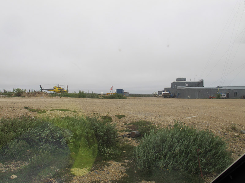
The view from our helicopter as we await takeoff at the Churchill Northern Studies Centre
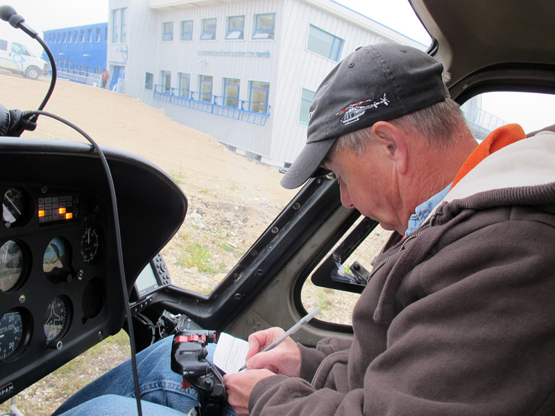
Robert, our pilot, fills in his logbook
The helicopter pilots, both with decades of experience, seemed quite cheerful and ready to go, so who were we to argue? So we buckled in and set off for our sites, some tens of kilometres inland on the bank of the Churchill River. As shown in the photos below, the conditions we met en route were sometimes almost artistically misty, but always acceptable for flight. And as we arrived at the first site the fog and rain began to depart, revealing a day that became, by lunchtime, quite splendid for fieldwork.
Down the Road
Churchill, Manitoba: August 25th, 2015
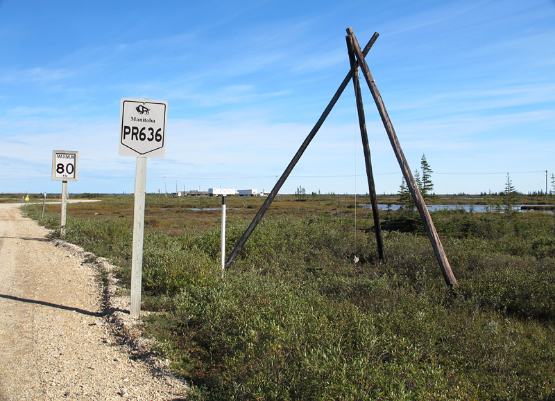
A cobble hanging from a tripod forms a humorous ad hoc “wind gauge” near the Churchill Northern Studies Centre.
Down the road there is always something new to see. Even on a road you have travelled before, there will be unseen treasures, just waiting by the roadside to be discovered.
At the Churchill Northern Studies Centre (CNSC), our 2015 field season was complete. It had been a fantastic two weeks, possibly the best ever, but now it was done. The samples had all been wrapped, bagged, boxed, and palletized. Together with the field gear they awaited shipping in the dark of the former CNSC building. Our clothes, boots, and rain gear had been stuffed into packs and duffles, we had cleared out “our” vehicle, and we had tidied all of the lab spaces we had temporarily occupied.
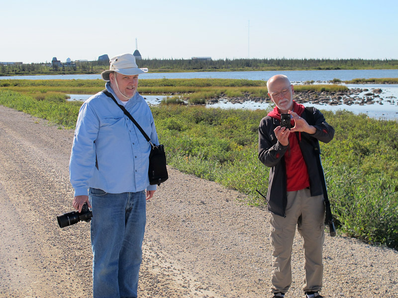
Michael Cuggy (L) and Dave Rudkin on the road, with the Churchill Northern Studies Centre on the horizon behind them.
We really had nothing left to do on this clear morning, which felt warm yet carried within the first hints of an early-arriving northern autumn. Nothing to do but put on our walking shoes, gather up cameras, sign out a shotgun, and take a wander down the launch road. Plenty of time to contemplate this beautiful land, to examine in detail a stretch of gravel that we normally passed at what passes for highway speed around Churchill. And, of course, plenty of time to feed a bit more blood to those Churchill mosquitoes.
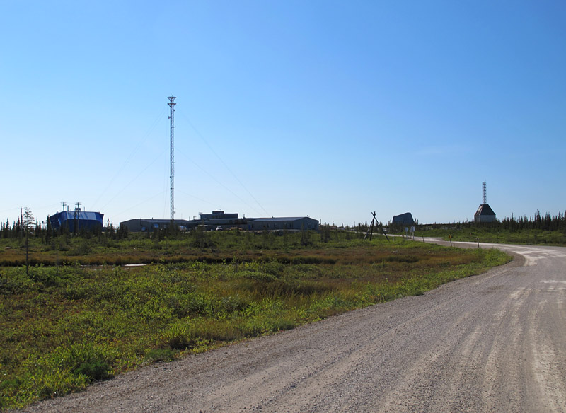
CNSC is to the left of the old research rocket range. The shrubs are already wearing the brown foliage of early autumn.
White Cross Breakdown
Grand Manan Island: July, 2015
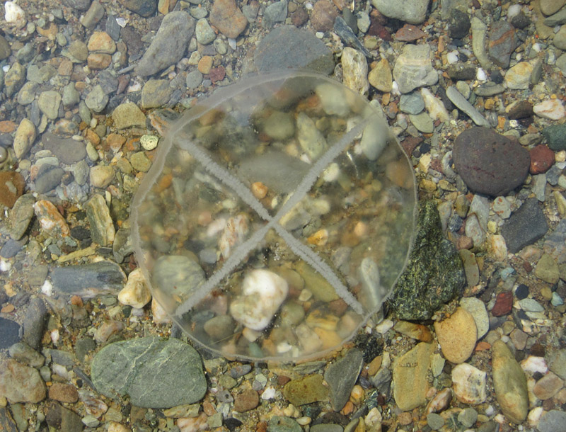
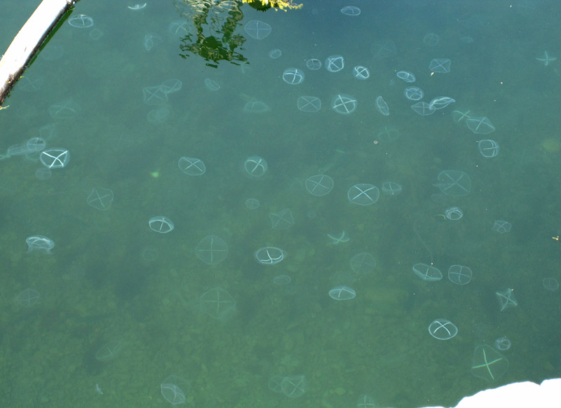
A living Staurophora mertensii over gravel in shallow water: the “white cross” represents canals and gonads.
Jellyfish are known for being short-lived. Not far from a jelly bloom where uncountable medusae swim and pulse, you might expect to find numbers of dead and dying jellyfish. In the case of the jelly bloom in North Head harbour this past summer, weakened and dying jellies were washing up nearby along the shore of Flagg’s Cove. On one unusually warm Saturday afternoon, so warm that it was pleasant to wade in the Bay of Fundy, I spent some time documenting the breakdown of white cross jellies, Staurophora mertensii. The images below show the generalized series of stages, from the living jelly to its near disappearance (this transition doesn’t take long!). As usual, my long-suffering family was remarkably tolerant of my slightly obsessive jelly observing.
Flagg’s Cove at low tide, with North Head harbour in the background
Why should I want to know what happens to white cross jellies when they die and decompose? For several years, I have been working on a detailed study of fossil jellyfish from the William Lake site in central Manitoba. Those jellies, which were alive some 445 million years ago, were hydromedusan cnidarians very similar to Staurophora. By carefully examining and documenting the jellies at Flagg’s Cove, I improved my understanding of the fossil jellies at William Lake, and of the processes they had passed through during fossilization. This will contribute to the interpretation of those fossils, as we work toward their scientific publication.
Me, jellywatching (photo by Vicki Young)
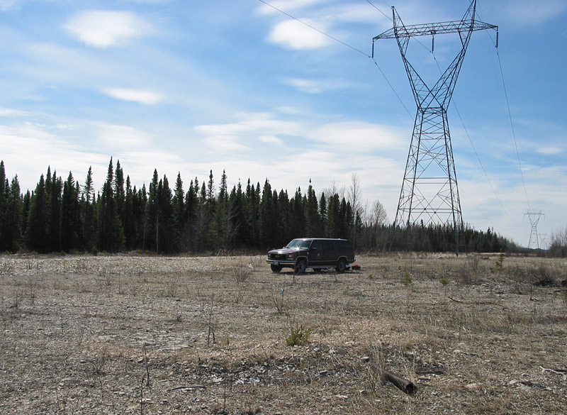
Number 82
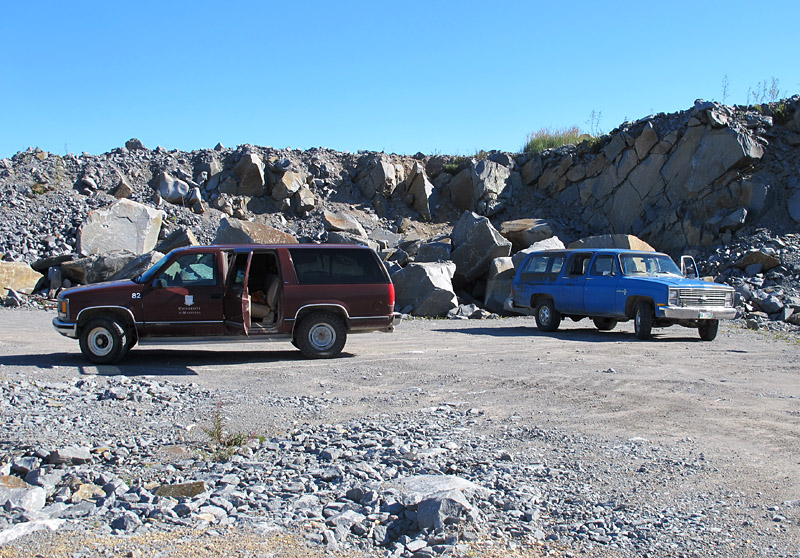
Number 82 and the 1976 Custom Deluxe, visiting a quarry in the Churchill quartzite.
Sometimes Good Things Come Back
A few weeks ago we arrived in Churchill to carry out a field project, staying at the Churchill Northern Studies Centre as we always do. We were a big group of scientists for the first week, and CNSC assigned us two Suburbans from their fleet. The older was a rather beaten 1976 version, tarnished and burnished by decades of wind-driven salt (it may be aged, but it is a “Custom Deluxe”; on one side this moniker has been abbreviated to a more appropriate “Cus”). The newer of the two was ex-University of Manitoba, as demonstrated by the U of M logo still in the process of being peeled from its doors by Churchill’s -40 winters. It also carried U of M number 82, and my colleague Nancy Chow commented that she thought she had used it in the distant past.
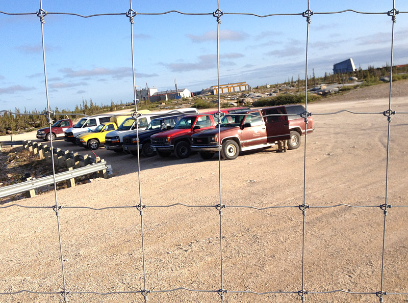
The Churchill Northern Studies Centre owns a quite a large fleet of vehicles, several of which are Suburbans of a certain age.
Later on, going through my digital photo collection I discovered that I had also used number 82, but quite some time ago. In spring of 2005 it had been our field vehicle in the Grand Rapids Uplands of central Manitoba. It was a fine truck for that work: reasonably comfortable seats, plenty of ground clearance, good power, and immense space for hauling colleagues, students, gear, and geological samples. The only downside, as I recall, was its voracious appetite for fuel.
Number 82 in the Grand Rapids Uplands, spring of 2005
Jelly Bloom at North Head
Grand Manan Island: July 12, 2015
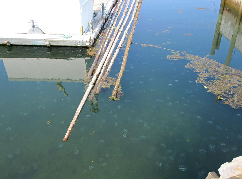
Mid-July, and there were a tremendous localized bloom of jellies in the harbour at North Head. It didn’t seem to extend very far outside the harbour at that time (it was mostly just dead jellies nearby in Flagg’s Cove), but at North Head the numbers were truly stunning. A few days earlier we had seen some moon jellies (Aurelia sp.), but most of this bloom was the white cross jelly (Staurophora mertensii) accompanied by occasional lion’s mane (Cyanea capillata) and a few large comb jellies (probably Beroe, though I couldn’t get a close look at any of them).
There are many ideas floating around these days about the causes of jelly blooms. Not knowing what was going on in the local environment, I can’t really speculate on the cause of what we saw at Grand Manan; all I can say is that it was a deeply memorable phenomenon.
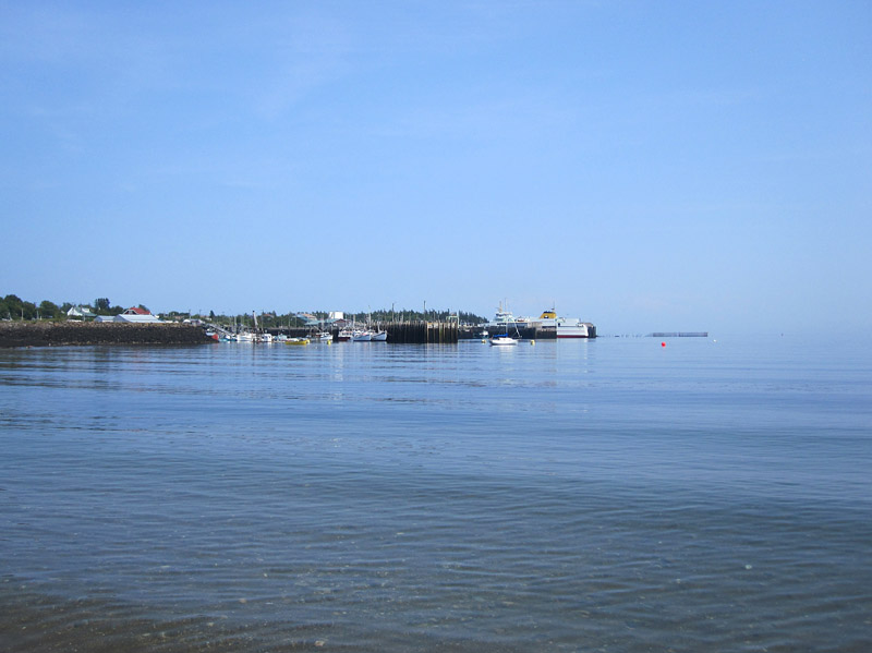
North Head harbour, viewed from Flagg’s Cove
Seal Cove Beach
Grand Manan Island, New Brunswick: July, 2015
Walking on the seashore, I am often struck by the diversity that can exist in a very small area. Certainly you can observe a range of features and life forms if you walk in a forest or across a grassland, but on the shore the diversity effects are magnified and multiplied by the juxtaposition of land, air and sea. Physical forces above and below tide line act upon the water, sediment, and rock; life forms respond to this complex and dynamic system with their own complexity and dynamism. On a summer morning the beautiful sands of Seal Cove beach may seem like a peaceful, idyllic place for a walk, but even at a time like this the change is constant, and if you look you are bound to be surprised.
The warming sun drives the last mist from the sands of Seal Cove beach.
What is the physical process that causes these remarkably regular tidal channels to form along the beach? I’m sure that there is an M.Sc. thesis to be found here!
The Anthropocene Unconformity

Coal Harbour, Vancouver
It has been suggested that our current time interval is different from all the times that preceded it, that human activities are dramatically affecting the Earth’s environment, atmosphere, and oceans. Geologists have long known the time since the end of the last ice age, about 12,000 years ago, as the Holocene Epoch, but about fifteen years ago it was proposed that we have passed from the Holocene into a new interval, the Anthropocene Epoch. The Anthropocene has not been accepted as a formal geological term, and its concept is still somewhat fuzzy. For instance, it does not yet have an agreed start date; it is most often considered to have begun around the start of the Industrial Revolution in the late 1700s, but other suggestions are that it began at the dawn of agriculture about 12,000 BP (in which case it would be virtually synonymous with the Holocene), or even with the first use of atomic weapons in 1945.
It is not easy to find much information about what the geological signature of the Anthropocene might be.* A lot is written about the magnitude of human effects on the modern environment, and geochemists have made many suggestions about characteristic chemical anomalies that can be seen in sediments and glacial ice cores, but how are we actually affecting geology that might be observed with the naked eye? A geological age should be readily recognizable in the sediment and/or rock record. The following are a few thoughts on things that geologists might be considering in some distant future . . .

Pembina Highway, Winnipeg
A few weeks ago I was working in my parents’ garden in the Maritimes. It was a rainy spring day, too wet to do much digging, so I drove to the garden centre and bought a few bags of crushed rock.** Returning to the house, I spent much of the afternoon alternating between happily trundling an empty wheelbarrow down the path through the trees, and somewhat less happily pushing a barrow full of gravel upslope through the drizzle. This sort of activity is wonderful for opening the mind, and as I spread and tramped the gravel, a thought entered that empty space between my ears: I am making an unconformity.
Which, surely, I was. The hill at Fredericton is underlain by grey and brown Upper Carboniferous sandstones between 330 and 300 million years old, which are thinly clad by soil and trees many places, and which yield the abundant fieldstone that rises to the surface with every spring melt. The sandstone is an excellent material for drystone walls, but apparently it doesn’t work well as an aggregate, and the most common crushed rock in that area is quite different: fine-grained, mid-grey material that breaks into sharp-edged pieces. When we were children who invariably scraped our knees by falling on gravel paths, we referred to this rock as “slate.” I am pretty sure that much of it comes from the quarry at Springhill, just up river from Fredericton, in which case it is geologically a wacke belonging to the Burtts Corner Formation, of mid Silurian age (about 435-420 million years old).

The path